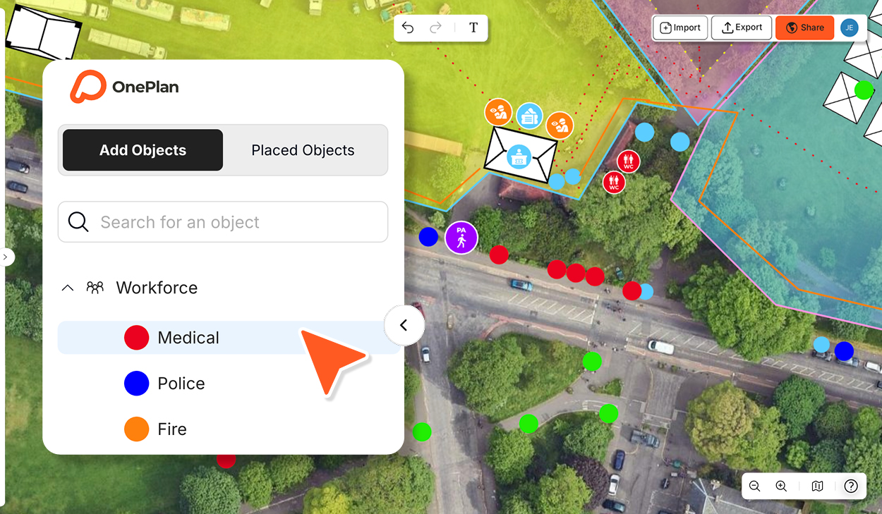
Location Planning Software

Location management software to plan indoor and outdoor locations efficiently and accurately. 

Previously planning took 2 weeks for 3-4 hours per day, plus many late nights. Since using OnePlan, it's saved 85% time!

Renna Muhieddin
Associate Producer for SoulFest

Features to make location planning easy

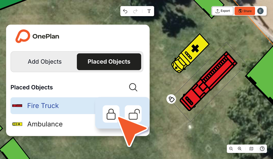
3.0_New Features_Lock-UnLock_897x522px_FA 1

Lock, unlock and hide objects

Lock objects in place, hide them from view, and unlock them anytime, keeping your plans secure and collaboration smooth.
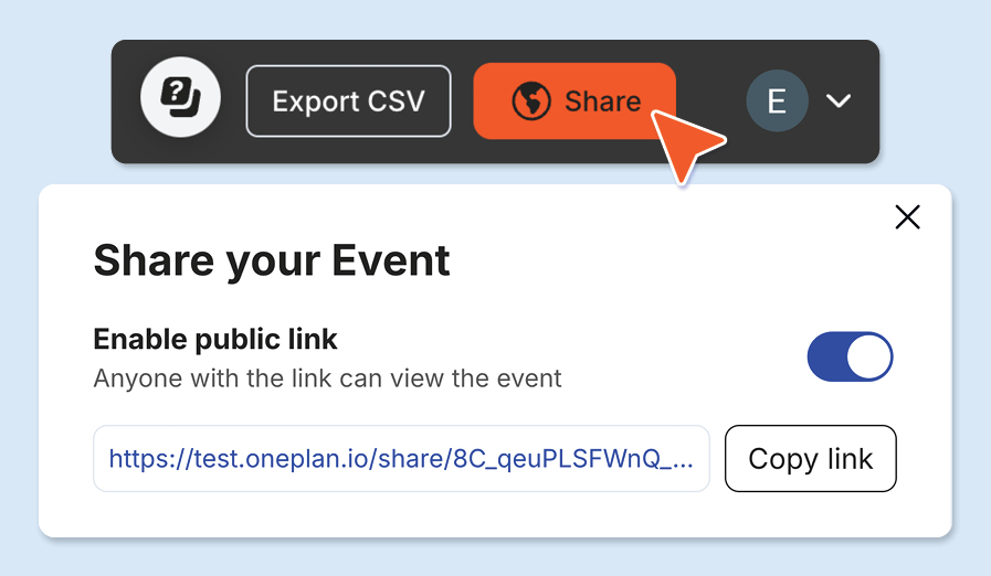
Share by link

Share your plans via view-only link

Generate a view-only link to share with your event stakeholders, so they can easily view your site plan.
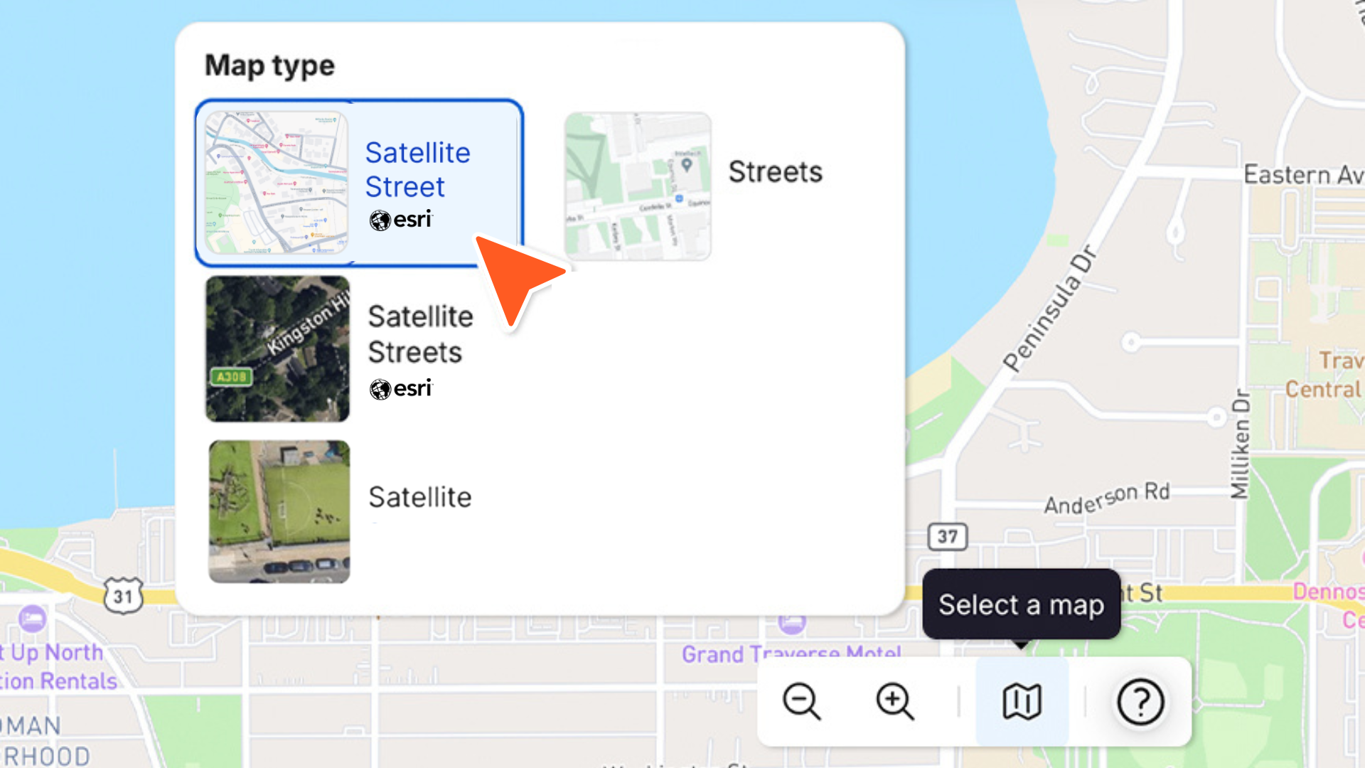
Esri Map Image

Choose from high-quality map options

Pick from a range of map options to plan on a map that suits your event best.
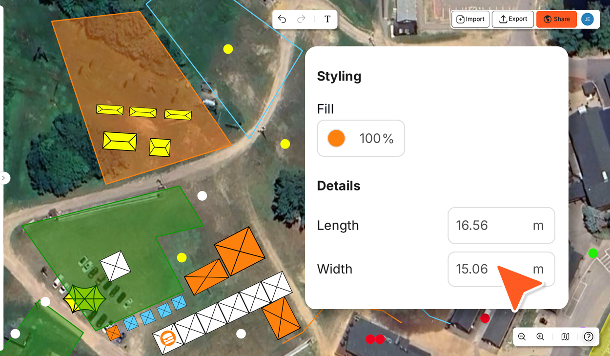
Features Image3
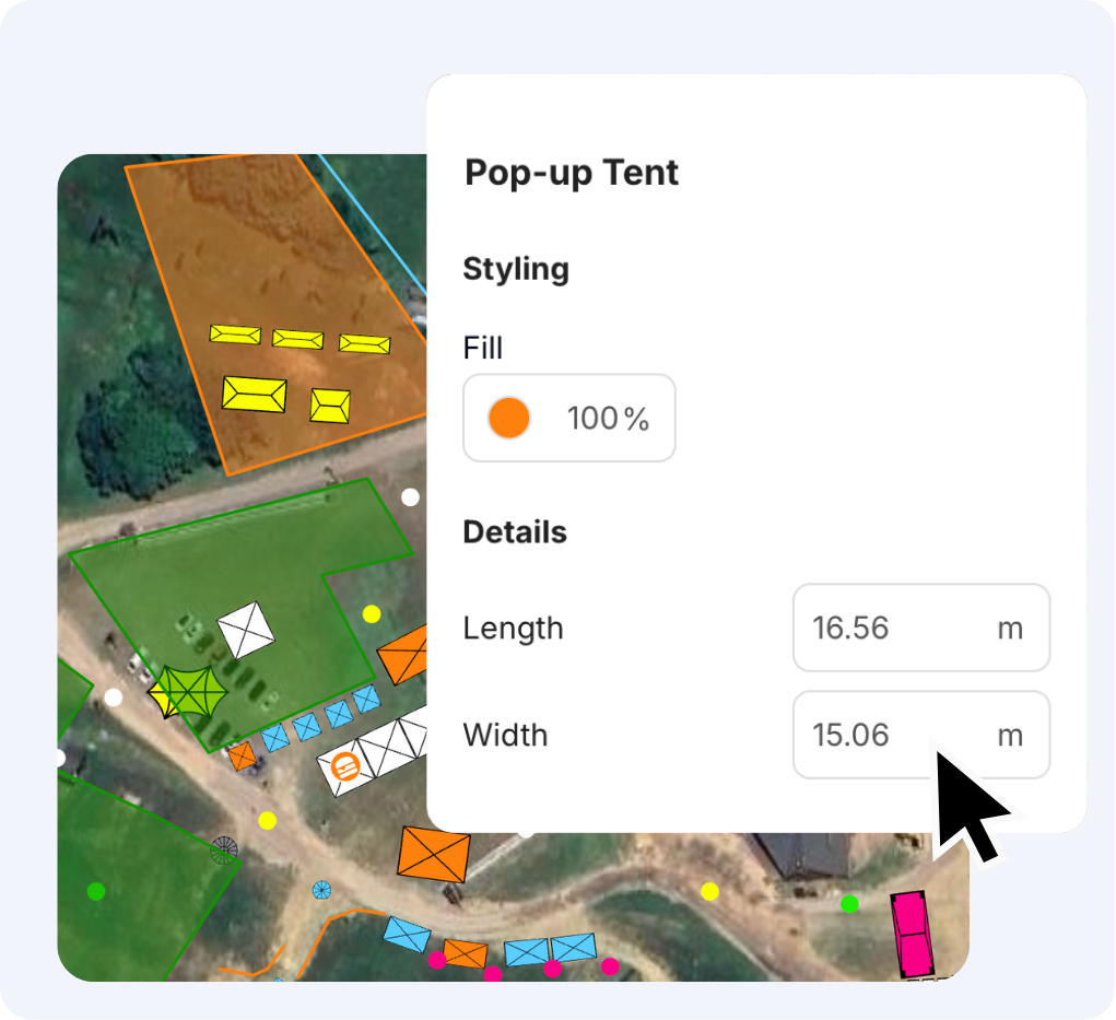
Resizing placed infrastructure

Resize placed infrastructure

Change dimensions of placed infrastructure using the object menu or bounding box.
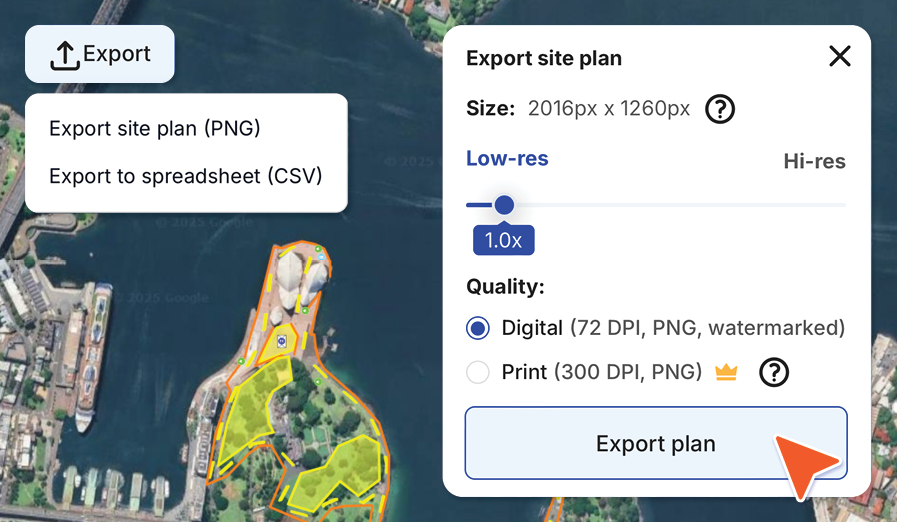
3.0_New Features_Box_Export Site Plan_897x522px

Export your site plans

Export your site plans to print or share digitally with stakeholders
Features Image2

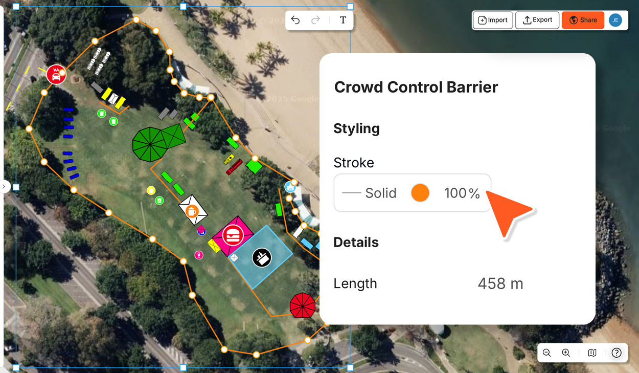
Instant calculations for placed areas, barriers and fencing

Instantly see the length of placed barriers in either metres or feet, keeping your plans to scale
export data in OnePlan

Export your object data to CSV

Export a CSV file of all objects placed on your map
Features Image

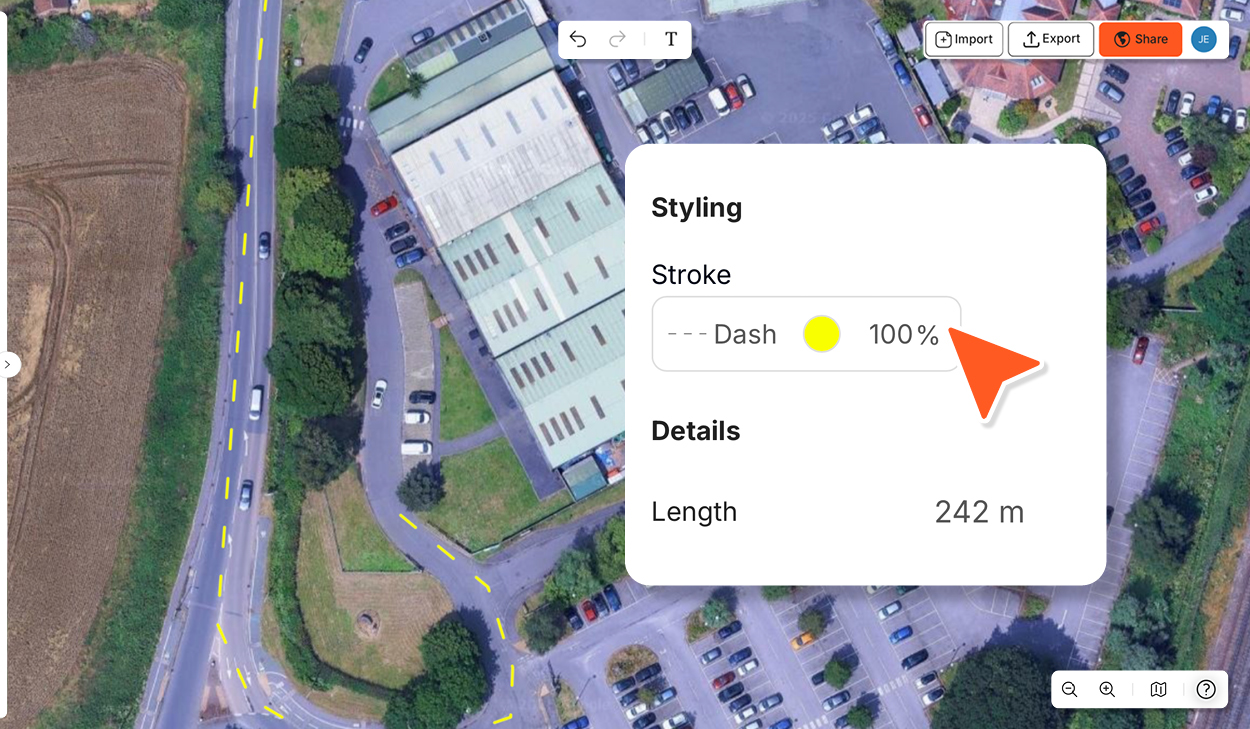
Seamless route plotting across your site

Map and customise pedestrian and vehicle routes across your event site.
Features Image44

Dot planning for your workforce

Easily dot plan your staff, so everyone knows where they need to be on the day.

Plan anything on a satellite map or floor plan

Festivals

Fairs

Air shows

Live Events

Plan any site

15 Sites Planned

650+ Object on
Site Plans

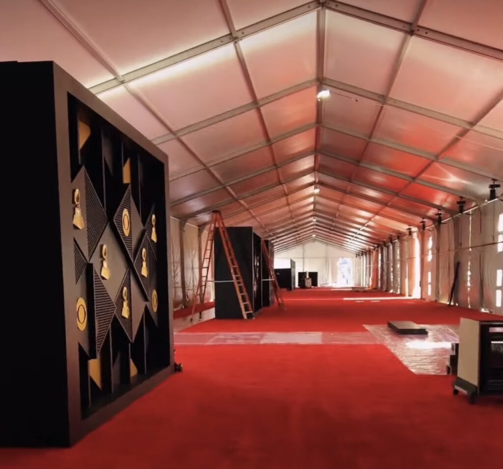
How the Joe Lewis Company Uses OnePlan for the GRAMMYs and Billboard Music Awards

"You don't have to fly somebody somewhere to pull a tape measure out and get measurements on site. You can do it right there from your computer."

Nouhad Captan Operations Lead,
Joe Lewis Company

Find the right package for you

Annual Pricing
|
Monthly Pricing
USD
|
GBP
|
EUR
|
CAD
|
AUD
|
NZD
USD
|
GBP
|
EUR
|
CAD
|
AUD
|
NZD

Free

Start planning your first event for free

$0 USD
1 event, 50 objects free

£0 GBP
1 event, 50 objects free

€0 EUR
1 event, 50 objects free

$0 CAD
1 event, 50 objects free

$0 AUD
1 event, 50 objects free

$0 NZD
1 event, 50 objects free

$0 USD
1 event, 50 objects free

£0 GBP
1 event, 50 objects free

€0 EUR
1 event, 50 objects free

$0 CAD
1 event, 50 objects free

$0 AUD
1 event, 50 objects free

$0 NZD
1 event, 50 objects free

Pro

Plan multiple events, with collaboration tools

$99 USD /month
 

£75 GBP /month
 

€89 EUR /month
 

$140 CAD /month
 

$149 AUD /month
 

$165 NZD /month
 

$74 USD /month
$888 USD billed annually

£56 GBP /month
£672 GBP billed annually

€66 EUR /month
€792 EUR billed annually

$105 CAD /month
$1,260 CAD billed annually

$111 AUD /month
$1,332 AUD billed annually

$123 NZD /month
$1,476 NZD billed annually

Team

Collaborate efficiently in teams of up to 10 people

$90 USD /month
 

£67 GBP /month
 

€80 EUR /month
 

$120 CAD /month
 

$125 AUD /month
 

$150 NZD /month
 

$75 USD /month
$900 USD billed annually

£55 GBP /month
£660 GBP billed annually

€67 EUR /month
€804 EUR billed annually

$100 CAD /month
$1,200 CAD billed annually

$104 AUD /month
$1,248 AUD billed annually

$125 NZD /month
$1,500 NZD billed annually

FAQ

OnePlan is a cloud-based site-planning software originally geared for events and venues, allowing planners to place objects, infrastructure, and workforce positions on to-scale maps.

For film production, the platform can serve similarly: you can import or use aerial/satellite or CAD-based layouts of your location, then plan placement of sets, cameras, lighting rigs, generator trucks, holding areas, parking, security zones, etc. Because it supports collaborative sharing and real-time editing, it helps your production team, art department, location manager and local authorities stay aligned.
Yes. OnePlan supports importing floor plans or layout drawings (including CAD) so you can plan from your existing materials.

For example: If you have a CAD-drawn site survey of a back-lot or location, you can import it and place infrastructure/objects on it using OnePlan’s drag-and-drop tools. This is especially helpful when you want to map rigging zones, generator placement, access roads, crew base, etc., with precision.

OnePlan is built for collaborative planning: you can share plans via link, invite vendors, crew, local authority bodies, or other stakeholders to view or edit.

In a film-location context, you might have your location manager, production designer, safety officer, grip/lighting lead and local permits office all looking at the same plan. Changes can be seen in real time, reducing the version problem of PDF drawings, spreadsheets and disparate emails. It helps avoid mis-communications on site.

Yes, it offers to-scale mapping and supports a variety of object types  with high precision.

While its core focus is event infrastructure, you can adapt its object-library to represent film-specific assets: camera platforms, crane bases, lighting towers, cable trenches, lay-down areas, VFX zones. The to-scale accuracy supports safety reviews, logistics flows , and stakeholder sign-off.

  1. Sign up for a free account: OnePlan offers a free trial or entry-level plan (50 objects free) so you can test with one location layout.
  2. Import your location drawing: Upload your site map, aerial image, CAD drawing or floorplan of the location (indoor/outdoor.
  3. Define your “objects”: Decide on a set of typical objects you’ll need (e.g., camera platforms, lighting towers, power units, grip trucks, parking, crew holding, catering zones, security fencing). Use OnePlan’s existing object library and adapt as needed.
  4. Collaborate with your team: Invite production designer, location manager, head of lighting/grip, transport coordinator, local authority liaison, and any external vendors (rigging, catering, security) to view/edit the plan.
  5. Run scenario-planning: Use the map to explore different layouts — e.g., alternative parking zone, generator repositioning, alternate cable layout — and share options visually rather than only verbally or via spreadsheets.
  6. Export/distribute: Once the layout is locked, export high-resolution site plan PDFs or share the live link with crews and vendors so they always refer to the current version.
  7. On-set updates & version control: Assign someone (perhaps assistant location manager) to update the plan in OnePlan if changes occur on-site (last‐minute rigging change, new equipment arrival, change in access route). Share updated link or export revision so all stakeholders are aligned.
  8. Review & archive: After production wrap, archive the plan for future reference (e.g., for a recurring location, future film return, health & safety review) or for insurance documentation.

Hit enter to search or ESC to close