Camping areas at events are more than just spaces to pitch a tent—they shape the attendee experience, affect safety, and influence how an event runs from start to finish.
Even the most well-organized festival can be let down by overcrowded campsites, long walks to facilities, or confusing layouts. That’s why using a campsite layout planner isn’t just practical—it’s essential.
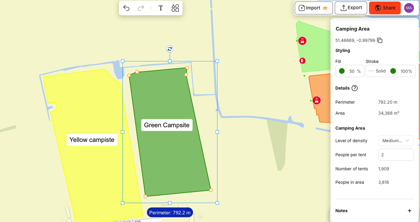
OnePlan’s campsite calculator allows event organizers to visually plan camping areas, estimate how many tents can fit safely, and understand how infrastructure, facilities, and access routes impact capacity, comfort, and cost.
Rather than relying on spreadsheets, OnePlan helps you balance space, safety, experience, and revenue.
Sign up free to try visual event and campsite planning.
What Is a Campsite Layout Planner?
A campsite layout planner helps you answer practical questions like:
– How many tents can safely fit?
– How much space should be reserved for toilets, showers, welfare areas, and roads?
– How do access routes, emergency lanes, and staff placement affect capacity?
– What is the optimal balance between camper comfort, safety, and revenue potential?
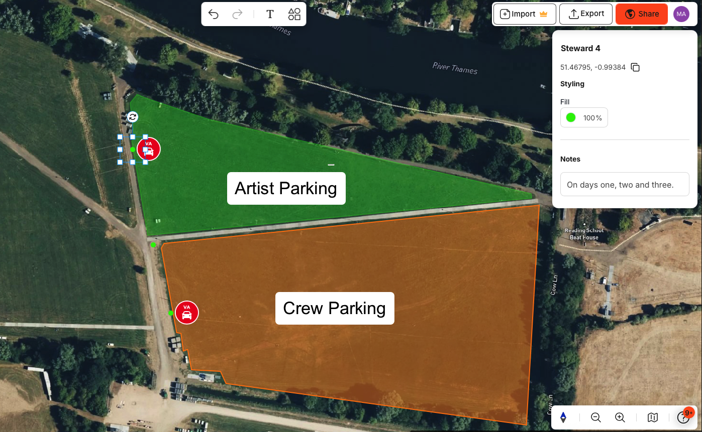
With OnePlan, you can draw camping zones on satellite maps or import files of existing layouts. When you adjust zones, facilities, and access routes, the campsite calculator updates capacity instantly.
Why Campsite Layout Impacts Attendee Experience
A campsite is often where attendees spend most of their time outside scheduled events.
Poor layout can lead to:
– Overcrowding and discomfort
– Difficulty accessing facilities
– Safety hazards and slower emergency responses
– Frustrated campers who share negative experiences on social media
A well-planned campsite using OnePlan ensures campers enjoy comfortable spacing, easy access to facilities, and a safe environment, directly boosting satisfaction and loyalty.
How to Calculate Campsite Capacity
Planning camping space goes beyond area measurement. Knowing how to calculate campsite area correctly is crucial.
Key factors include:
- Usable land area: Exclude slopes, waterlogged zones, and non-usable terrain.
- Tent or unit spacing: Apply regulations for fire safety, minimum distances, and comfort.
- Infrastructure and facilities: Allocate space for toilets, showers, waste, lighting, water points, and food vendors.
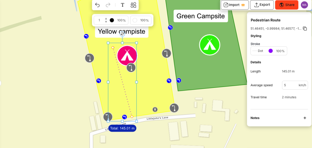
- Access and emergency routes: Maintain clear fire lanes, walkways, and evacuation paths.
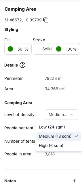
OnePlan’s campsite calculator consolidates all these elements, helping you balance maximum capacity with comfort, safety, and cost efficiency.
Planning “What If?” Scenarios
Events are unpredictable. Rain, higher ticket sales, or temporary restrictions can force last-minute adjustments.
With OnePlan, you can create different versions of your plan to quickly deploy them in various scenarios like:
-
Reduced usable space due to wet conditions
-
Expansion of VIP or family camping zones
-
Adjusting for temporary facilities or additional welfare areas
-
Shifting staff and security to cover new high-traffic areas
-
Reduced usable space due to wet conditions
-
Changing infrastructure and facilities in different zones if there’s a higher number of people per tent than anticipated
All calculations update in real time, helping you evaluate the impact on camper numbers, infrastructure costs, and staff requirements. Plans can be shared by link, and viewed live on a computer, tablet or mobile so the event team can quickly adapt to any last-minute changes.
Collaborate Easily With Stakeholders
Campsite planning requires coordination with multiple teams: security, vendors, infrastructure suppliers, and local authorities.
OnePlan allows you to:
– Share interactive maps and plans via link
– Export layouts as PNGS for documentation
– Clearly demonstrate compliance with safety and regulatory requirements
– Align vendors and suppliers on exact space allocation for facilities and services
Place Staff Where They Matter
Staff placement is key to a safe and smooth campsite. With OnePlan, you can position stewards, security, and welfare teams precisely on the map. Post-event, you can analyze incidents against staff locations to improve future planning.
Frequently Asked Questions (FAQs)
A visual tool to help event organizers design camping areas, calculate safe camper numbers, and plan infrastructure and access routes.
It allows you to draw zones on satellite maps or existing file layouts and updates tent capacity as you adjust the size of areas, facilities, and access routes.
Measure usable land, apply safe tent spacing, allocate space for infrastructure and facilities, and account for access and emergency routes.
Yes, it produces clear, shareable plans that can demonstrate compliance with safety, fire, and local authority requirements.
Absolutely. OnePlan lets you model variations in capacity, layouts, and facilities to evaluate impact on comfort, revenue, and staffing.
Yes, you can position stewards, security, and welfare staff precisely and analyse placement post-event.
Yes, it supports greenfield festivals, managed camping zones, staff camps, and vendor camping areas across multiple locations.