
Written by: Paul Foster, Founder, CEO, OnePlan
Key Takeaways
- Incomplete or non-scale road closure plans are the top reason special event permits get delayed or rejected by reviewers.
- A compliant traffic control plan must include a geo-accurate base map, lane closures, detour routes, signage, barriers, emergency access, and a clear legend.
- Most jurisdictions require 30–60 days for permit approval, and starting with a complete, to-scale plan prevents costly revision cycles.
- Common denial triggers include missing emergency corridors, outdated versions, incomplete signage, and lack of neighbor notifications, all avoidable with one living plan.
- OnePlan helps event teams create permit-ready road closure plans faster and more accurately, book a demo to see how.
Traffic Control Plan Checklist: 10 Elements You Need
Most jurisdictions require the same core elements in a TCP, even if the exact format varies. Use this checklist as your universal starting point, then verify requirements with your local authority, city transportation department, or public works office, because requirements differ by city, state, and country.
- To-scale base map. A geo-accurate street or satellite map at a stated scale. Every barrier and sign must be placed in the same scaled drawing.
- Lane closure layout. Exact location, length, and width of each closed lane, including taper lengths at entry and exit points.
- Detour route. A clearly marked alternative path for displaced traffic, with directional arrows and distance indicators.
- Signage placement. All regulation-correct signs from the applicable national or state sign catalogue (for example, MUTCD in the US), positioned to scale on the map.
- Barrier and cone placement. Type, quantity, and spacing of all physical controls, including water-filled barriers, jersey barriers, traffic cones, and delineators.
- Emergency vehicle access lanes. Dedicated corridors with minimum width and turn-radius indicators confirmed with fire and EMS.
- Traffic control officer positions. Named or numbered positions for flaggers or police officers, with shift coverage noted.
- Pedestrian and cyclist routing. Temporary sidewalk closures, crosswalk relocations, and alternative pedestrian paths.
- Event infrastructure overlay. Start and finish gantries, timing mats, fencing, staging, and any other structures that affect the roadway.
- Plan legend and north arrow. A complete legend identifying every symbol used, a north arrow, scale bar, event name, date, and version number.
Requirements vary significantly by jurisdiction, with different documentation thresholds depending on the event. Build one single, up-to-date plan that you can export cleanly for each reviewer rather than maintaining separate files per agency.
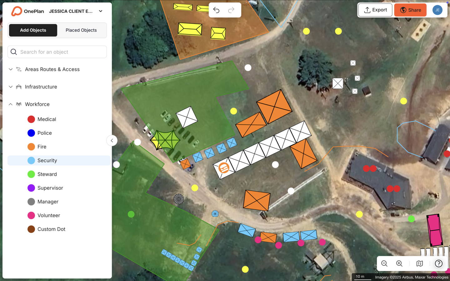
Once you know which elements your plan must include, you can plan the time you need to get that plan approved.
Road Closure Permit Timelines for Special Events
A realistic window is 30 to 60 days for most mid-scale events, though larger productions or those requiring multiple agency sign-offs can run longer. The following steps reflect a typical US process, so always confirm timelines with your specific city or county office.
- 60+ days out: Begin your TCP, confirm the route with local transportation or public works, and identify all required agency approvals. In New York City, SAPO applications for street events must be submitted 45 days, 30 days, or 14 days in advance, depending on the size.
- 45–60 days out: Submit your primary permit application with the TCP attached. Philadelphia requires standard special event applications to be submitted at least 90 days in advance to qualify for the standard $25 fee, and later submissions incur a $75 expedited fee.
- 30–45 days out: Respond to any agency revision requests. This stage is where an inaccurate or incomplete TCP costs the most time.
- 21–30 days out: Confirm secondary approvals from the fire marshal, police, and EMS. NYC Parks Department requires special events permit applications to be submitted at least 30 days before the event.
- 10–14 days out: Distribute the final approved plan to all operational stakeholders and contractors.
- Event day: Carry printed and digital copies of the approved TCP on site.
Indianapolis’s special events office recommends early engagement for any event requiring street closures, especially for events on arterial roads or those that coincide with other city activities. Across NYC, Philadelphia, and Indianapolis, the common pattern is that the clock starts when a complete, reviewable plan lands on the reviewer’s desk, not when you begin drafting it. One living plan, updated in real time, keeps that clock running in your favor.
Required Map Elements and Detour Details
A traffic control plan must include lane-closure tapers, detour routes, emergency-access lanes with width and turn-radius indicators, and placement of all regulation-correct signs, barriers, beacons, cones, and traffic controllers. Beyond those functional elements, reviewers also expect a map that communicates clearly at a glance.
A complete map legend for a road closure plan must translate every visual element into a standardized symbol that reviewers can interpret without guessing. That typically includes:
- Road closure line (solid red or orange), which defines the exact boundary of the closure.
- Detour route (dashed arrow with direction), which shows displaced traffic where to go.
- Barrier type (symbol keyed to product spec), which confirms that physical controls match the plan.
- Sign type and MUTCD code, which proves regulatory compliance.
- Traffic control officer position (numbered circle), which identifies staffing locations.
- Emergency access corridor (green hatching or dashed green line), which demonstrates safety access.
- Event infrastructure (gantry, timing mat, fencing, each with its own symbol), which maps all roadway obstructions.
- Scale bar, north arrow, version number, and event date, which provide orientation and version control.
To-scale standards matter because reviewers measure from the plan. A detour route that appears to fit a two-lane residential street on a non-scale sketch may not actually accommodate a bus or emergency vehicle. OnePlan’s base layer is a live satellite or street map built on leading GIS technology, so every object placed on it, from a cone line to a finish gantry, stays accurately to scale as you zoom. The area and perimeter calculator instantly returns dimensions in feet, so you can confirm that a 12-foot emergency access lane actually fits before submitting.
The Sydney Harbour 10k team at Pont3 uses OnePlan’s HD map integration to create centimeter-accurate plans for a route that runs past the Sydney Opera House and Harbour Bridge. That level of precision satisfies permit reviewers in complex urban environments.
Insurance Requirements and Neighbor Notifications
Most jurisdictions require event organizers to carry general liability insurance and name the city or county as an additional insured. Special event permit regulations in Washington State commonly require event organizers to maintain insurance and indemnify the jurisdiction against liability as a standard condition for permit approval. Coverage minimums vary, so confirm the required limit with your permitting office, as figures differ by jurisdiction and event scale.
Neighbor and business notifications now function as a formal requirement in many places rather than a courtesy. Many jurisdictions require organizers to notify neighbors in advance and obtain permission from affected homeowners before road closures.
A notification letter should include the event name and organizer contact, date and hours of road closure, affected street segment, detour route summary, and a phone number or email for questions. Attach a simplified version of your TCP map so recipients can see exactly what is closing and where traffic will be redirected. Keeping that map in OnePlan means you can export a clean, high-resolution version for the notification package at any point without rebuilding it from scratch.

Top Reasons Road Closure Permits Get Denied
Permit denials cluster around a predictable set of problems, and most of them trace back to the plan itself:
- Non-scale or illegible maps. Fix: use a live, geo-accurate map base and confirm scale bar accuracy before submission.
- Missing emergency access corridors. Fix: mark dedicated EMS and fire lanes with explicit width dimensions on the TCP.
- Incomplete signage inventory. Fix: place every sign on the map and cross-reference against the applicable sign catalogue, such as MUTCD in the US.
- No detour route or an infeasible one. Fix: trace the detour on the actual street network and verify turn radii accommodate the largest expected vehicle.
- Outdated or version-mismatched plans. Fix: maintain one living plan with a visible version number and date, and never submit a file that does not match what is on the ground.
- Missing insurance certificate or wrong additional insured wording. Fix: request the exact certificate language from the permitting office before ordering the certificate.
- Late or absent neighbor notifications. Fix: build notification deadlines into your permit timeline and document delivery with email read receipts or certified mail.
Each of these is a documentation problem, not an event problem. A single, up-to-date plan that all reviewers can access removes the version-mismatch issue entirely and makes it straightforward to show that every required element is present.
Tools to Create Professional Road Closure Plans Without CAD
Most event organizers build their first road closure plan in PowerPoint, Excel, Canva, Photoshop, Google Maps, or internal static, top-view screenshots and plan files. The output looks like a plan, but it is not to scale, and permit reviewers notice that immediately.
CAD software solves the scale problem but introduces a different one. It was built for engineers, carries a steep learning curve, and requires expensive specialists for anything beyond basic drafting. Stadium’s National Operations Manager Sam Wilson put it directly: “It would take me a day to do eight maps in CAD. In OnePlan, it’s just 2 hours.”
OnePlan sits between those two extremes. It is as easy to pick up as a drag-and-drop tool and as accurate as the engineering software. The base layer is a live satellite or street map, every object placed on it stays to scale, and the auto-generated Bill of Quantities turns the finished map into an exportable inventory of every sign, barrier, and cone, with no re-keying required. Plans export to high-resolution PNG for permit submission, print-ready up to A0.
The results across road events stay consistent:
- The Tour of Britain, an 8-stage, 1,352 km national race, reduced site visits by 75%, saved 300+ hours per year, and achieved a 3x ROI, with plans ready six months in advance as a living plan until race day.
- The Beirut Marathon cut approximately 20 pre-event site visits down to 1–2 per year, saving nearly a month of planning time for a 49,000-runner race.
- Stadium completed 18–20 traffic management plans in OnePlan between May and the time of their interview, with minimal training required for the team.
OnePlan includes over 130 running event-specific elements, including routes, cones, signs, police positions, aid stations, and indoor site plans, so road event organizers are not starting from a blank canvas.
How to Measure the Success of Your Road Closure Plan
A road closure plan succeeds when it does its job without drama. The clearest indicators are:
- First-submission approval. No revision requests mean the plan was complete, to scale, and legible on the first pass.
- Fewer revision cycles. Each round of revisions adds days or weeks to the permit timeline. Tracking revision count per event year over year shows whether plan quality is improving.
- Reduced site visits. Remote planning on an accurate map base means fewer trips to measure what is already on the plan.
- Accurate infrastructure counts. The Bill of Quantities should match what arrives on site. Discrepancies indicate the plan was not to scale or was not kept current.
- Stakeholder alignment on event day. Police, fire, public works, and contractors all work from the same plan version with no last-minute surprises.
These metrics compound over time. An event that earns first-submission approval builds credibility with the permitting office, which often translates to faster review cycles in subsequent years. One living plan, maintained from initial submission through event day, supports all of these outcomes.
Frequently Asked Questions
How far in advance should I apply for a special event road closure permit?
For most mid-scale events, 60 days is a safe minimum. Larger events involving multiple agency approvals, including fire, police, public works, and transportation, often need 90 days or more. Some jurisdictions set hard deadlines, and Philadelphia charges an expedited fee for applications submitted with less than 90 days’ notice. Start your traffic control plan at the same time you begin the application, not after, so you have a reviewable document ready when the permit office asks for it.
Which agencies typically review a road closure plan for a special event?
The reviewing agencies vary by jurisdiction, but the most common are the city or county transportation or public works department, the local police department, the fire marshal or fire department, and emergency medical services. Larger events may also involve a parks department, a transit authority, or a state department of transportation if the closure affects a state-maintained road. Confirm the full list with your permitting office early, because missing a required sign-off is one of the most common causes of permit delays.
Does my road closure plan need to be drawn by a professional engineer?
Requirements vary by jurisdiction and event scale. Some cities require a licensed traffic engineer or registered design professional to stamp a TCP for closures on arterial roads or highways. Others accept organizer-prepared plans for smaller events on local streets. Check with your local transportation or public works department before investing in professional drafting. Every jurisdiction does require, regardless of who prepares it, a plan that is drawn to scale and includes all mandatory elements.
What is the difference between a traffic control plan and a road closure permit?
A road closure permit is the legal authorization issued by the relevant authority that allows you to close a public road for your event. A traffic control plan is the technical document, the to-scale map showing exactly how the closure will be managed, that you submit as part of the permit application. The permit cannot be issued without an approved TCP. Think of the TCP as the evidence that your closure is safe and manageable, and the permit as the formal approval that follows.
Can I reuse a road closure plan from a previous year’s event?
You can reuse a prior plan with updates. A plan from a previous year is a strong starting point, but it needs to reflect any changes to the route, infrastructure, signage standards, or local requirements before resubmission. Permit offices will check the version date, and submitting an outdated plan is a common trigger for revision requests. Keeping your plan as a living document in OnePlan means updates are made in real time on the same map, so the version you submit is always current, and the Bill of Quantities updates automatically to match.
Conclusion: Build One Compliant Road Closure Plan
A road closure plan that earns first-submission approval shares the same characteristics every time. It is drawn to scale on a geo-accurate map, it includes every required TCP element, it is kept current through the permit process, and every reviewer works from the same version. The tools that most organizers reach for, including static screenshots, PowerPoint, and Google Maps, cannot deliver that. CAD can, but at a cost in time, money, and specialist dependency that most event teams cannot absorb.
OnePlan closes that gap. It is drag-and-drop simple, built on live mapping technology, and produces the professional, to-scale outputs that permit reviewers need, without a CAD license or an engineering degree. The Tour of Britain, the Beirut Marathon, and Stadium’s Coventry Moves operation all run their road closure planning in OnePlan. Thousands of race directors, local government events teams, and production leads across 150 countries do the same.
Your first event is free. You can start placing objects on your map in seconds, or talk to the team about what a permit-ready road closure plan looks like for your specific event.